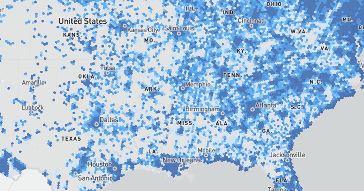
Don’t know if your area has broadband internet or 5G yet? On Friday, the Federal Communications Commission released new broadband maps showing where high-speed internet access and mobile 5G service is available across the US.
The FCC’s prior coverage maps have been inaccurate, showing that Americans should have been able to get online with higher speeds when they weren’t covered by internet service providers. Or if they were, they were getting far below the 25Mbps download speed threshold that the FCC established to be considered broadband internet. With these new maps, Americans can see internet speeds they can get at any street address in the country.
“These maps provide the best picture available to date of where broadband is and is not available across the country, and the maps will only get better from here,” FCC Chair Jessica Rosenworcel said in a release Friday.
The maps represent a significant tool to bridge the digital divide, allowing the government, companies and consumers to better locate gaps in coverage and address them. The lack of equal access to internet services has been a problem the US has wrestled with for years, one that pandemic lockdowns exacerbated as work, school and socializing went online.
Thanks to the Broadband DATA Act, the FCC must release maps showing where Americans can get wired internet access. They’ll be updated roughly every six months with new data from ISPs and carriers, and individuals can submit corrections if they can’t get access.
These maps also show different carriers’ mobile network availability at various speed tiers: 5Mbps download speeds for 4G LTE, along with 7Mbps and 35Mbps for 5G. The FCC requested data from Verizon, AT&T, T-Mobile and Dish about where their services will provide these speeds 90% of the time and have formalized those into coverage maps to compare.
In a statement the CTIA, a trade organization representing the wireless industry, praised the release of the new maps and noted that the group “looks forward to continuing to work with the Commission to achieve Congress’s goal of creating more granular, accurate maps to inform important broadband policy and funding decisions to promote deployment across the country.”
“Knowing exactly where broadband is and, importantly, where it is not, is critical to successfully bridging the digital divide. We applaud the FCC for its diligent work to bring these maps to life by completing the first step to precisely identify all broadband-serviceable locations in the U.S., which is key to bringing high-speed connectivity to all Americans,” said Rhonda Johnson, executive vice president of federal regulatory relations at AT&T.
“We know this is not a ‘one and done’ effort and we will continue to work with the Commission at each stage of this process to ensure the maps have the most accurate view of broadband availability.”
These new maps will also be handy for mobile plan subscribers comparing the coverage of different providers as they provide a way to examine service without relying solely on carrier-produced coverage maps that can differ in their speed and availability. T-Mobile, for instance, provides coverage maps that indicate where subscribers will get at least 2Mbps download speeds 85% of the time, though T-Mobile found very little difference in coverage between their availability and the FCC’s 90% availability maps.